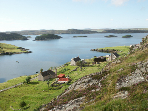
Cromore
The name of Cromore is thought to be derived from the Gaelic meaning big pen or fold but the word Krà in Norse means corner or inlet.
Cromore is situated on the peninsula between Loch Cromore and Loch Erisort. Land raiders could be stopped at the narrow neck of land where the bridge now fords Loch Cromore and the waters of Loch Erisort that flow down the south side of Crobeg and at the east end of Loch Cromore. Two very significant sites at Cromore are Dun Cromore and Eilean Chaluim Chille.
Dun Cromore, sometimes called Dun Ban, dates to the Pictish era. The Dun was probably used as a refuge from sea raiders as the spread of the shoreline would be impossible to defend.
The Dun was built as a double-walled fortress with an underwater causeway of stepping stones set in a random pattern and with a gap in the middle which would cause an attacker to plunge into the water. Early references to the Dun suggest that walls were from seven to ten feet in diameter and on the Southerly aspect still stand around fourteen feet in height above the water today. Captain Thomas in his description, mentions that within the gallery at the time of his visit in 1921 ‘a stair of seventeen steps led to a third gallery, and underneath them a smaller stair led down from a second but with no exit.’
On the North side of the fort there is a walled enclosure into which cattle could be made to swim for shelter and safety. The foundations of two oblong cottages built at a later stage were identified in this enclosure by surveyors.
The Dun is on a small island in the middle of the brackish water loch. At high tides, the sea enters Loch Cromore on the west side of the village and into two lochs in line on the east side. At these times, the lochs have fresh and salt water fish in them, the haunt of the brown trout being invaded by cod and rock fish.
Eilean Chalum Chille (St Colm’s Isle) is undoubtedly one of the most important links to St Columba and his monks who would have resided at this religious centre, which has influenced Hebridean life to this day. St Columba was born in Ireland in 521 AD and died in Iona in 597 AD. While it is difficult to be precise about dates, it is likely that this became a centre of religion over 1,200 years ago.
The ruins of the old church are impressive and still stand to full height on at least two of the walls. In later years the church was used as a place of burial, and one account by J Sands in 1876, refers to a visit to the island when he saw coffins one on top of the other to a height of ten feet. In 1833, Rev Robert Finlayson states in his Statistical Report that the ground round the church at St Colm’s was the only place of interment in the parish of Lochs. Boats carrying funeral remains would cross the loch to Port na Marbh on the north of the island and the procession would then walk across the island to the church and burial ground.
Originally the Lochs parish reached all the way across to Carloway and burials from the whole area including Keose and Crossbost would have come to the island for burial. In more recent times burials from Cromore used to go to Crossbost by boat. For many years the Martha, owned by Finlay Smith, was used to ferry funerals across Loch Erisort and it wasn’t until a really wild day in 1960 that the first funeral was taken by road to Crossbost. This was the funeral of Murchadh Alasdair, Alasdair Macarthur, 10 Cromore and it was transported by Murchadh Iain Sheonaidh in his van, no other funeral since then has gone by sea. The Martha was an 18-foot boat with an inboard engine. This same boat brought supplies from Stornoway for many years.
There are references to highly fertile gardens on St Colm’s Isle but also references to Leis an Theambuill ‘the Garden of the Temple’ which is on the croft at No 5 Cromore. It seems likely that this garden had links to the church and inhabitants of the isle at one time.
Booklet available.
Cromore genealogy on Hebridean Connections.
